This route leaves the ten city lists for car-accessible nature and temple pins across provinces. Expect trailheads with parking, short ferry hops, and one steeper granite staircase day. Pack layers for mountain weather and aim autumn or spring for clearer ridge light.
Recommended route — visit in this order
Curated 10-day road trip. Follow the numbers so you don't get lost.
Numbers show visit order. The cart auto-sorts your stops. Use Google Maps for turn-by-turn driving.
All stops — details
A curated 10-day road trip across South Korea with 9 scenic stops, driving directions, and landmark guides.

Ulsanbawi Peak
Gangwon-do · Stop #1
Ulsanbawi (Korean: 울산바위) or Ulsan Rock is a rock with six peaks. It is situated in Seoraksan National Park in Sokcho, Gangwon Province, South Korea.

Gosu Cave
Chungcheongbuk-do · Stop #2
Gosu Cave (Korean: 고수동굴), alternatively Kosu Cave, is a huge limestone cave near Danyang (North Chungcheong Province), South Korea formed over 450 million years ago. It is among the best known natural caves in Korea, and is known as the "underground palace".
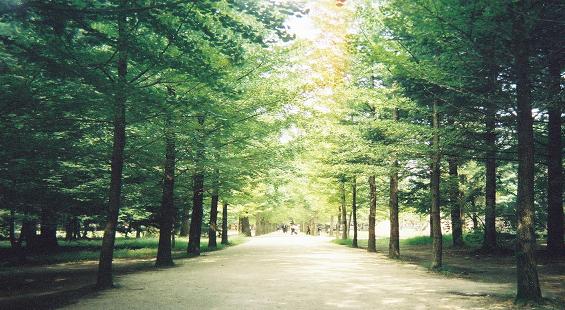
Nami Island
Gangwon-do · Stop #4
Namiseom or Nami Island (Korean: 남이섬) is a half-moon shaped river island located in Chuncheon, Gangwon Province, South Korea, formed as the land around it was inundated by the rising water of the Bukhan River (northern part of the Han River) as the result of the construction of Cheongpyeong Dam in 1944.

Maisan Tapsa Temple
Jeollabuk-do · Stop #5
Tapsa (Pagoda Temple) and the Stone Pagodas of Mount Mai is a small Korean Buddhist Temple complex found in the Maisan (Horse Ear Mountain) in Jinan County, North Jeolla Province, South Korea.

Haeinsa Temple
Gyeongsangnam-do · Stop #6
Haeinsa (Korean: 해인사) is a Buddhist temple in Gayasan National Park, South Gyeongsang Province, South Korea. It is the head temple of the Jogye Order of Korean Seon Buddhism.

Boseong Daehan Dawon Tea Plantation
Jeollanam-do · Stop #7
Operating since 1957, Daehan Dawon is South Korea's largest and most famous green tea plantation. Tiered green tea bushes step rhythmically down hillside slopes bordered by towering cedar trees, featuring hilltop viewpoints over the South Sea.

Juwangsan Yongchu Falls
Gyeongsangbuk-do · Stop #8
Juwangsan is a mountain of North Gyeongsang Province, eastern South Korea. It has an elevation of 721 metres.

Seopjikoji
Jeju Special Self-Governing Province · Stop #9
Situated on the eastern shore of Jeju Island, Seopjikoji is a dramatic coastal promontory carpeted with yellow canola flowers in spring. Red volcanic scoria soil cliffs drop into crashing waves surrounding the white Bangdupo Lighthouse.

Upo Wetland
Gyeongsangnam-do · Stop #10
Upo Wetland (Korean: 우포늪) is a complex of natural wetlands located in Changnyeong County, South Gyeongsang Province, South Korea. It is located in portions of Yueo-myeon, Ibang-myeon and Daehap-myeon, near the Nakdong River.
Свързано съдържание
Frequently asked questions
- What is the South Korea adventure route on ViaPins?
- A curated 10-day road trip across South Korea with 9 scenic stops, driving directions, and landmark guides.
- Do I need a car for the South Korea adventure?
- Yes. The ViaPins South Korea adventure route is designed for self-drive travel between regional landmarks.
- How do I follow the South Korea itinerary?
- Open the adventure page on ViaPins, review each stop, and use the built-in route planner to navigate with Google Maps.