Explore France beyond the cities with this nature adventure route.
Recommended route — visit in this order
Curated 10-day road trip. Follow the numbers so you don't get lost.
Numbers show visit order. The cart auto-sorts your stops. Use Google Maps for turn-by-turn driving.
Todas las paradas — detalles
A curated 10-day road trip across France with 10 scenic stops, driving directions, and landmark guides.

Mont Blanc
France · Stop #1
Mont Blanc (UK: ; US: ) is a mountain in the Alps, rising 4,807. 3 m (15,771,9 ft) above sea level, located right at the Franco-Italian border.

Gorges du Verdon
France · Stop #2
The Verdon Gorge (French: Gorges du Verdon Occitan: Gòrja de Verdon) is a river canyon located in the Provence-Alpes-Côte d'Azur region of Southeastern France. It is about 25 km (15.

Dune du Pilat
France · Stop #3
The Dune of Pilat (French: Dune du Pilat [dyn dy pila], official name), also called Grande Dune du Pilat, is the tallest sand dune in Europe. It is located in La Teste-de-Buch in the Arcachon Bay area, France, 60 km (37.

Calanques National Park
France · Stop #4
Calanques National Park (French: Parc national des Calanques; Occitan: Parc Nacional dels Calanques) is a French national park located on the Mediterranean coast in Bouches-du-Rhône, Southern France. Established in 2012, it extends over 520 km2 (201 sq mi), of which 85 km2 (33 sq mi) is land, while the remaining is marine area.

Étretat Cliffs
France · Stop #5
Étretat (French pronunciation: [etʁəta]) is a commune in the Seine-Maritime department in the Normandy region of Northwestern France. It is a tourist and farming town situated about 32 km (20 mi) northeast of Le Havre, at the junction of the D 940, D 11 and D 139 roads.

Camargue Regional Natural Park
France · Stop #6
The Camargue (, also UK: , US: , French: [kamaʁɡ]; Provençal: Camarga) is a coastal region in southern France located south of the city of Arles, between the Mediterranean Sea and the two arms of the Rhône river delta. The eastern arm is called the Grand Rhône; the western is the Petit Rhône.

Pyrenees National Park
France · Stop #7
Pyrénées National Park (French: Parc national des Pyrénées; Occitan: Parc Nacional dels Pireneus) is a French national park located within the departments of Hautes-Pyrénées and Pyrénées-Atlantiques. The park is located along the border of France and Spain along the Pyrenees Mountains, with a scenic landscape offering a variety of outdoor activities including hiking, skiing, mountain climbing and observing wildlife.

Mercantour National Park
France · Stop #8
Mercantour National Park (French: Parc national du Mercantour) a French national park located in the Alpes-de-Haute-Provence and Alpes-Maritimes departments. Since it was created in 1979, the park has proven popular, with 800,000 visitors annually enjoying the 600 km (372 mi) of marked footpaths and visiting its villages.
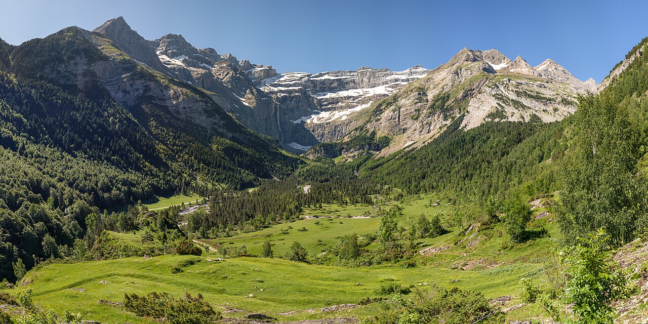
Cirque de Gavarnie
France · Stop #9
The Cirque de Gavarnie (French pronunciation: [siʁk də ɡavaʁni]) is a vast cirque in the central Pyrenees, in southwestern France, close to the border of Spain. It is within the commune of Gavarnie, the department of Hautes-Pyrénées, and the Pyrénées National Park.

Vanoise National Park
France · Stop #10
Vanoise National Park (French: Parc national de la Vanoise) is a French national park between the Tarentaise and Maurienne valleys in the French Alps, containing the Vanoise Massif. It was created in 1963 as the first national park in France.
Contenido relacionado
Frequently asked questions
- What is the France adventure route on ViaPins?
- A curated 10-day road trip across France with 10 scenic stops, driving directions, and landmark guides.
- Do I need a car for the France adventure?
- Yes. The ViaPins France adventure route is designed for self-drive travel between regional landmarks.
- How do I follow the France itinerary?
- Open the adventure page on ViaPins, review each stop, and use the built-in route planner to navigate with Google Maps.